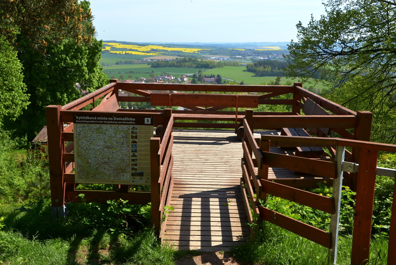
Lookout towers in the region
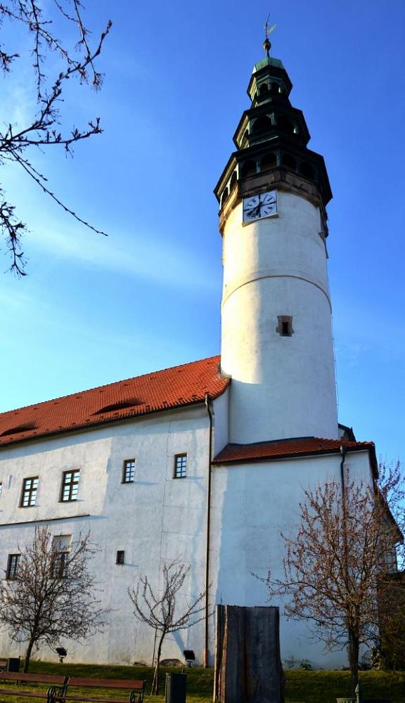
The leaning tower at the Church of the Nativity of the Virgin Mary
Visitors are invited to climb the 194 stairs of this Domažlice tower, which leans 59 cm off its axis.
Enjoy a breathtaking view!
OPEN:
1 May -30 September
May, June, September: Tue - Sat: 10.00 a.m. - 12.00 and 1.00 - 4.00 p.m.
Sun: 1.00 - 4.00 p.m.
July, August: Mo - Sat: 9.00 a.m. - 12.00 and 1.00 - 5.00 p.m.
Sun: 1.00 - 5.00 p.m.

Tower of Chodsko castle
Have a wonderful view of the town from the Castle tower.
OPEN:
April – October: Mon-Sun 9-12 am and 1-5 pm
November- March: Mon-Fri 9-12 am and 1-4 pm
24.12. 9-12 o´clock
CLOSE: 25.12., 26.12., 31.12., 1.1.
CONTACT: Chodské náměstí 96, Domažlice
phone: + 420 379 776 009
https://www.muzeum-chodska.com/chodsky-hrad/
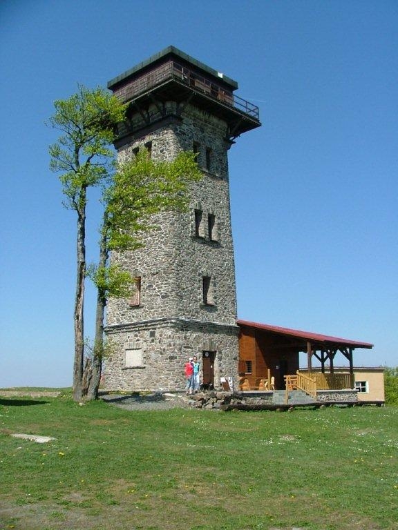
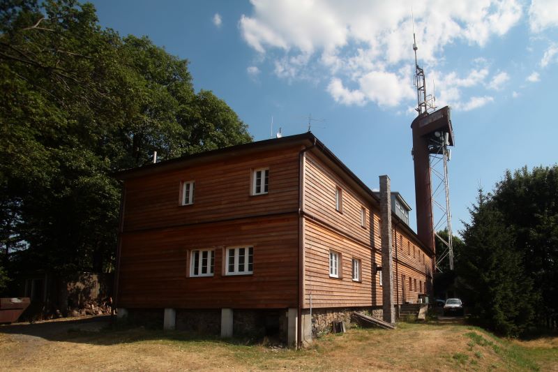
Čerchov (1042 m)
The highest hill of the Bohemian Forest with a lookout tower. Enjoy the breathtaking view of Bohemia and Bavaria.
OPENING TIMES FOR TOWER:
May, June,Sept., Oct: Sat, Sun, bank holidays: 10.00 a.m. – 5.00 p.m.
daily July, August: 10.00 a.m. – 5.00 p.m.
CONTACT:
Phone: +420722166875
Parking in Capartice, then walk to Čerchov 4,7 km.
Bus connection during weekends and bank holidays from June to September from Domažlice or Capartice to the hill Čerchov:
- timetables in tourist information centres
- booking seats (and bicycle holders) in advance : +420 379 793 161, +420 777 330 313
- the bus is equipped with 5 bicycle holders
Distance from Domažlice: 19 km
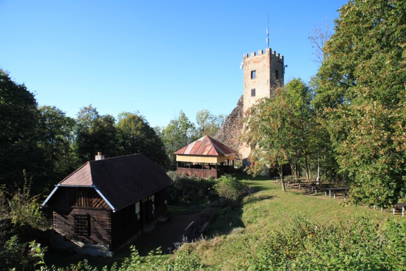
Castle ruin Rýzmberk with lookout-tower
OPEN:
June - August: Tues. - Sun: 10.00. a.m. - 4.30 p.m.
GPS:49.4069533N, 13.0306769E
Distance: on foot 12 km, 14 km cycling
Koráb
On the top of the hill Koráb, at a hight of 773 m, is a lookout tower with a chalet with year-round operation. Koráb heights exceeds the surroundings countryside and is surrounded by extensive mixed forests. There is peace and high air purity throughout the year.
OPEN:
1.6. - 31.8.: 10.00 a.m. - 7.00 p.m. daily
other days: 11.00 a.m. - 6.00 p.m. daily except Mon.
CONTACT:
Kdyně 466
phone + 420 775 133 728
https://horskachatakorab.estranky.cz/
GPS: 49.3953656N, 13.0753964E
Distance: on foot 16km,cycling 18 km, by car 17 km
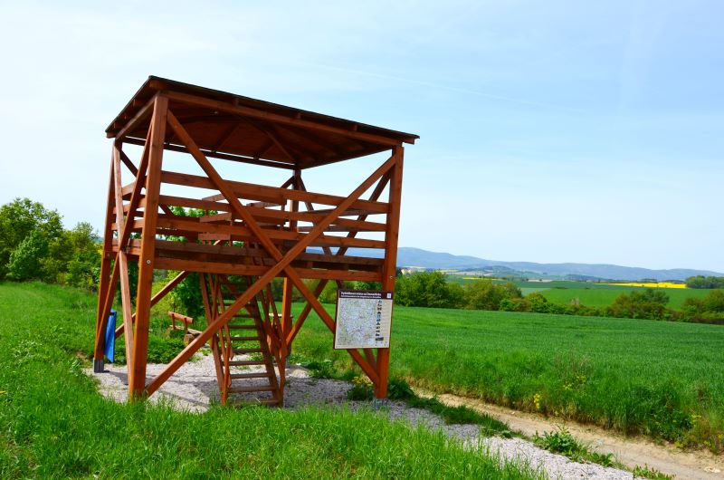
Detail [»] Šibeniční vrch
Observation tower on Šibeniční vrch
Šibeniční vrch
Observation tower on Šibeniční vrch

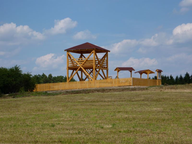
Lookout tower on Šibeniční vrch (459 metres a.s.l.) was built in 2010 on the site where the Chapel of Our Lady of Lourdes was standing in the past. Tower is 21,5m high and has 65 stairs. It is freely accessible all year. Enjoy the wonderful view from the top.
GPS:
Distance:
The St. Peter and St. Paul´s Church Tower
The 38 meters high church tower offers magnificient views to visitors who ascend its 98 steps.
OPEN:
June and September - Sat. and Sun: 9.00 - 12:00 a.m. and 1.00 - 4.00 p.m.
July, August - Tues. - Sun.: 9.00 - 12.00 a.m. and 1.00 - 4.00 p.m.
Chrastavice
It is located at an altitude of 460 m. After climbing 14 steps you will get a view of Herštejn, Koráb, Malý and Velký Ostrý and Malý and Velký Javor, Čerchov and Baldov.
The lookout tower is located near a picturesque village. Nearby is a nature trail and archaeological site - Cemetery burial from the 13th century BC.
GPS:49.4609214N, 12.9537897E
Distance: 3,9 km
Tlumačov - Kubíčkova skála
The view place is located at a height of 513 m in close proximity to the village Tlumačov. Tlumačov is 4km south of Domažlice.
GPS:49.4071172N, 12.9241161E
Distance: 4,6 km
Hrádek hill
Outlook place above the traditional village of Újezd is at 585 m high, close to view place is a statue of the rebel Jan Sladký Kozina, a playground, a big sculpture of a dog, a themed restaurant.
GPS: 49.4310206N, 12.8616136E
Distance is 7 km, start of the walking trails in the square near the Monastery church (GPS: 49.440258N, 12.9276642E), red trail.
Distance from Újezd: 800 m, red trail.
Díly
Czech - German lookout in the village Díly, at a hight 610 m.
The view point is attached to the municipal office building. It is possible to enter the viewpoint throught alley between the municipal office and the fire station. Access to the viewpoint is not limited.
GPS: 49.4461544N, 12.7873989E
Distance on foot: 17km, by car: 13 km, cycling: 16 km
Čermná
View point from a height of 2.5 meters offers a view of the peaks of the Bohemian Forest or Šumava mountains. The view point is 450 m above sea level and 200 m from the Čermná village.
GPS: 49.5341806N, 13.1219364E
Distance: cycling:24 km, by car:25 km
Puclice
The wooden structure (at a hight 427m) is 5 meters high and was made available to tourists in 2013 as part of a project of Czech-German cooperation. From this place south, a Jewish cemetery is hidden on the edge of the forest.
Puclice was an important Jewish community.The 1st Jews in Puclice were mentioned in the year 1724. In 1849 there were 10 Jewish families living in the village. A significant landmark of the Jewish settlement is the cemetery which was established in 1750. The burial ground is one of the most preserved Jewish cemeteries in the Domažlice district.
GPS: 49.5491339N, 13.0177731E
Distance: 19 km by car, cycling: 30 km
Kvíčovice
The view point is the center of a picturesque village where we can see the Baroque chapel, which is included in the list of immovable cultural monuments.
GPS:49.5890769N, 13.0731081E
Distance: 26 km by car, 31 km cycling
Semněvice 378m
The five-metre-high wooden view point was built in 2012 as part of Czech-German cooperation. After climbing 13 steps, you will get a view of the Sedmihoří Nature Park or the Bohemian Forest from a height of 2.5 m.
GPS: 49.6010481N, 12.9271611E
Distance: 23 km by car, 20 km cycling
Bělá nad Radbuzou
The wooden viewing platform ( at a hight 524 m) was built in 2014 and is 5 meters high, you can see the town or the Bohemian Forest.
GPS: 49.6011811N, 12.7294647E
Distance: 29 km by car, 33 km cycling